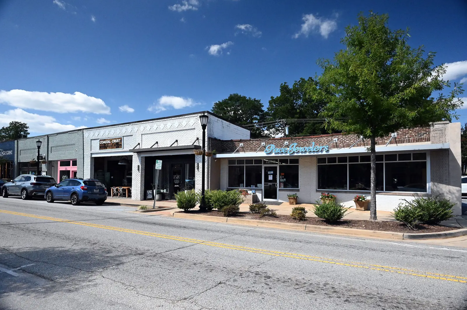
West Greenville, along Pendleton Street, has about 1,300 residential addresses, mostly in ZIP 29611, and almost all are zoned for Berea High.
Last checked Oct. 16, 2026. Sources: the City of Greenville’s West Greenville neighborhood plan page and GIS layers (special emphasis neighborhoods, National Register sites, address points, parks); Greenville County Schools’ Find Your School; the state’s 2025 school report cards; Zillow Research; Greenlink’s published GTFS schedule; and OpenStreetMap.
West Greenville is the neighborhood along Pendleton Street west of the West End, where the street’s older storefronts hold shops and small businesses, with blocks of mill-era houses and newer townhouses behind them. The city maps it as one of its special emphasis neighborhoods and has a West Greenville neighborhood plan.
What this means for you
- Zoned high school: Berea High for 38 of the 40 addresses we checked. Confirm yours with Find Your School.
- Home value: $213,642 in ZIP 29611 in September 2026, according to the Zillow Home Value Index.
- Nearest interstate exit: I-385 exit 42 (U.S. 276, Stone Avenue), about 2.8 miles by road.
Part of our Greenville neighborhoods guide.
Where it is
This guide uses the city’s West Greenville special emphasis neighborhood boundary: about half a square mile with roughly 1,300 residential addresses in the city’s address file. About 560 are single-family houses, about 650 are apartment or condo units and about 100 are townhouses. About 75% are in ZIP code 29611 and 25% in 29601. All are inside city limits, so the city provides police, fire and trash service.
The Woodside Cotton Mill Village Historic District, listed on the National Register of Historic Places on April 30, 1987, reaches into the area, according to the city’s National Register layer.
Schools
We looked up 40 residential addresses spread across the area in Greenville County Schools’ Find Your School tool for the 2026-27 school year. Ratings are the overall ratings on the 2025 state report cards.
| Level | School | Share of addresses | 2025 rating |
|---|---|---|---|
| High | Berea High, 201 Burdine Drive | 95% | Average |
| High | Greenville Senior High Academy, 1 Vardry St. | 5% | Excellent |
| Middle | Lakeview Middle, 3801 Old Buncombe Road | 50% | Average |
| Middle | League Academy, 125 Twin Lake Drive | 45% | Good |
| Middle | Berea Middle, 151 Berea Middle School Road | 5% | Average |
| Elementary | A.J. Whittenberg Elementary, 420 Westfield St. | 70% | Good |
| Elementary | Alexander Elementary, 1601 Bramlett Road | 25% | Excellent |
| Elementary | Hollis Academy, 200 Goodrich St. | 5% | Good |
The state’s scale runs Excellent, Good, Average, Below Average and Unsatisfactory. Middle and elementary zones split inside the neighborhood, so look up the exact address. More in our schools guide.
Home values
The typical home value in ZIP 29611 was $213,642 in September 2026, up 3.85% from $205,714 in September 2025, according to the Zillow Home Value Index. In 29601, which covers the eastern quarter of the area along with downtown, it was $571,299, up 0.76%. The index is a modeled typical value for the middle third of homes, not a sale price, and 29611 covers a large part of the west side outside city limits. The citywide figure was $328,460. More in our home prices guide.
Parks and trails
- West Greenville Community Center, 8 Rochester St., with the park beside it. See the city’s community center page.
- Walker Park, 309 Cypress St., inside the area. See the city’s park page.
- Mayberry Park, next to the area, with a trail on the city’s trail map.
- Unity Park, 320 S. Hudson St., about a fifth of a mile east, the city’s 60-acre park with the Swamp Rabbit Trail. See the city’s Unity Park page.
More in our parks and trails guide.
Getting around
- Interstate: I-385 exit 42 (U.S. 276, Stone Avenue), about 2.8 miles by road, or I-185 exit 15 (U.S. 25, White Horse Road), about 4.4 miles, by the exit numbers in OpenStreetMap.
- Downtown: about 1.8 miles by road to Main Street at Washington Street.
- Airport: about 16 miles by road to GSP International Airport. These are distances on the OpenStreetMap road network, measured with the OSRM routing engine, not drive times.
- Greenlink: Routes 502 White Horse and 506 Woodside stop inside the area, according to Greenlink’s published schedule data.
More in our getting around guide.
Groceries and everyday stores
OpenStreetMap shows no supermarket inside the area. The nearest pharmacies are Avita Pharmacy, 811 Pendleton St., just east, and Parker Rd Drug Store, 1319 Woodside Ave.
How we drew this area
West Greenville’s edges here are the City of Greenville’s special emphasis neighborhood of that name. Counts and ZIP codes come from the city’s address points; school shares from 40 addresses checked in Find Your School on Oct. 16, 2026. Store locations are © OpenStreetMap contributors.
Frequently asked questions
Is West Greenville a good place to live?
Here are the facts. West Greenville is one of the city’s special emphasis neighborhoods, along Pendleton Street west of the Reedy River, with about 1,300 residential addresses. Of 40 addresses we checked, 38 are zoned for Berea High, rated Average on the 2025 state report card. Zillow put the typical value in ZIP 29611 at $213,642 in September 2026.
What high school is West Greenville zoned for?
Berea High for 38 of the 40 addresses we checked in Find Your School for 2026-27, and Greenville Senior High Academy for the other two. Middle school is split between Lakeview Middle and League Academy.
What ZIP code is West Greenville in?
Mostly 29611. About a quarter of its residential addresses, on the side nearest downtown, are in 29601.
Where is the West Greenville Community Center?
At 8 Rochester St., run by the City of Greenville.
Have your say